Trail Walking Le Glaizil - 20190528_Chapeau de l'évêque via Le Glaizil - Photo

20190528_Chapeau de l'évêque via Le Glaizil

© OpenStreetMap contributors
Length
Length
10.8 km
Max alt
Max alt
1532 m
Uphill gradient
Uphill gradient
712 m
Km-Effort
Km-Effort  
20 km
Min alt
Min alt
917 m
Downhill gradient
Downhill gradient
711 m
Boucle
Boucle
Yes
Creation date :
2019-05-28 07:31:49.867
Updated on :
2019-05-28 19:40:21.652

(1 Reviews)

Walking
Walking
4h46
Difficulty : Medium

Scan this QR Code to open this trail in the SityTrail application

FREE GPS app for hiking

Logo SityTrail SityTrail

IGN / Geographical institutes

Download SityTrail from the App Store Download SityTrail from Google Play

Logo SityTrail SityTrail World

The world is yours!

Download SityTrail from the App Store Download SityTrail from Google Play Download SityTrail on Huawei AppGallery

About

Trail Walking of 10.8 km to be discovered at Provence-Alpes-Côte d'Azur, Hautes-Alpes, Le Glaizil. This trail is proposed by PapouBertrand.

Description

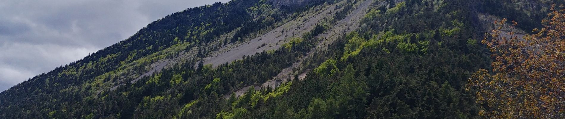
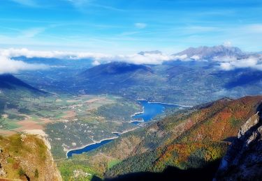
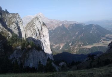
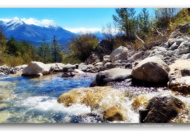
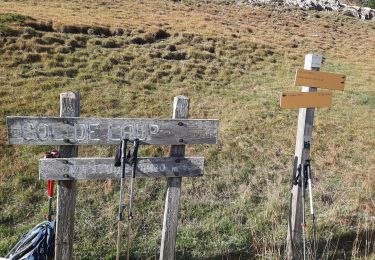
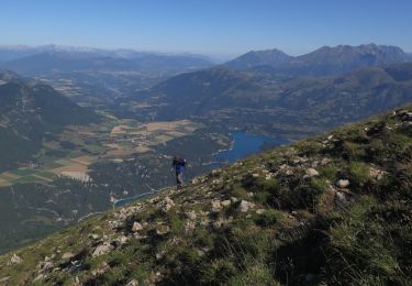
Jolie randonnée dans la Forêt du Sapet, assez facile avec une très belle vue panoramique au sommet du chapeau de l'évêque,  point de vue sur les hauts sommets du Valgaudemar et panorama exceptionnel sur le Champsaur et l'entrée de l'étroite vallée du Valgaudemar. Le hameau de Lesdiguières, visible de là, abrite les ruines du château du dernier connétable de France, François de Bonne, Duc de Lesdiguières.

Elevation profile

Photos

Positioning

Country:
France
Region :
Provence-Alpes-Côte d'Azur
Department/Province :
Hautes-Alpes
Municipality :
Le Glaizil
Location:
Unknown
Start:(UTM)
736398 ; 4959627 (31T) N.

Comments

Please log in to post a review or rate the element


Trails nearby

Trail Walking Saint-Jacques-en-Valgodemard - Tour du Vieux Chaillol 1/5 - Gite Les Paris au Gite Le Casset - Photo
Walking
tracegps

Walking

Medium
(1)
Saint-Jacques-en-Valgodemard, Provence-Alpes-Côte d'Azur, Hautes-Alpes, France
20 km | 27 km-effort
6h 30min
No
Trail Walking Le Dévoluy - Pic Perrioux - Photo
Walking
PapouBertrand

Walking

Very difficult
Le Dévoluy, Provence-Alpes-Côte d'Azur, Hautes-Alpes, France
11.1 km | 25 km-effort
6h 39min
Yes
Trail Walking Le Dévoluy - Le Faraut. Pic pierroux - Photo
Walking
nadd73

Walking

Medium
Le Dévoluy, Provence-Alpes-Côte d'Azur, Hautes-Alpes, France
10.3 km | 25 km-effort
7h 10min
Yes
Trail Walking Saint-Firmin - Les pres hauts  6 kms - Photo
Walking
peillo

Walking

Saint-Firmin, Provence-Alpes-Côte d'Azur, Hautes-Alpes, France
5.2 km | 9.6 km-effort
1h 55min
Yes
Trail Walking Le Glaizil - Chapeau de l'évêque via le Glaizil - Photo
Walking
PapouBertrand

Walking

Very difficult
Le Glaizil, Provence-Alpes-Côte d'Azur, Hautes-Alpes, France
10.3 km | 19.8 km-effort
3h 56min
Yes
Trail Walking Le Dévoluy - pic pierroux - Photo
Walking
gibello

Walking

Difficult
Le Dévoluy, Provence-Alpes-Côte d'Azur, Hautes-Alpes, France
11.4 km | 26 km-effort
6h 8min
Yes
Trail Walking Le Dévoluy - 2-F - Photo
Walking
GAPIAN43

Walking

Very difficult
Le Dévoluy, Provence-Alpes-Côte d'Azur, Hautes-Alpes, France
11.1 km | 28 km-effort
5h 11min
Yes
Trail Walking Le Dévoluy - pic pierroux - Photo
Walking
Gouze13

Walking

Difficult
Le Dévoluy, Provence-Alpes-Côte d'Azur, Hautes-Alpes, France
9.3 km | 23 km-effort
4h 0min
Yes
Trail Walking Aubessagne - Le Château (la Clappe) par le sentier paysager de Beaurepaire - Photo
Walking
Luc Saint-guillain

Walking

Medium
Aubessagne, Provence-Alpes-Côte d'Azur, Hautes-Alpes, France
5.5 km | 6.7 km-effort
1h 31min
Yes


Close
My subscriptions